Site Content
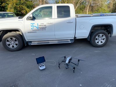
DRONE SURVEYING / PHOTOGRAPHY
Johnny J. Williams Land Surveying has incorporated drone services to assist in larger survey projects. The drone flies over the site after ground control is established and records more extensive details on the site conditions than would typically be available with conventional surveying equipment. Drone assisted surveying is most useful on topographic, ALTA, and larger site surveys where infrastructure must be shown on the map.
Johnny J. Williams Land Surveying also offers aerial photography of home sites, farming operations, commercial sites, or business operations. Photographs are offered in a digital format including 4k videos. Johnny J. Williams Land Surveying can also print these photographs on photo paper on a large format printer which allows for prints up to 36” wide.